More books on The Bulge
My prime battlefield interest, as you may know, is the Battle of the Bulge. And I keep reading books, often taken from the list of references in other books.
Operation Nordwind
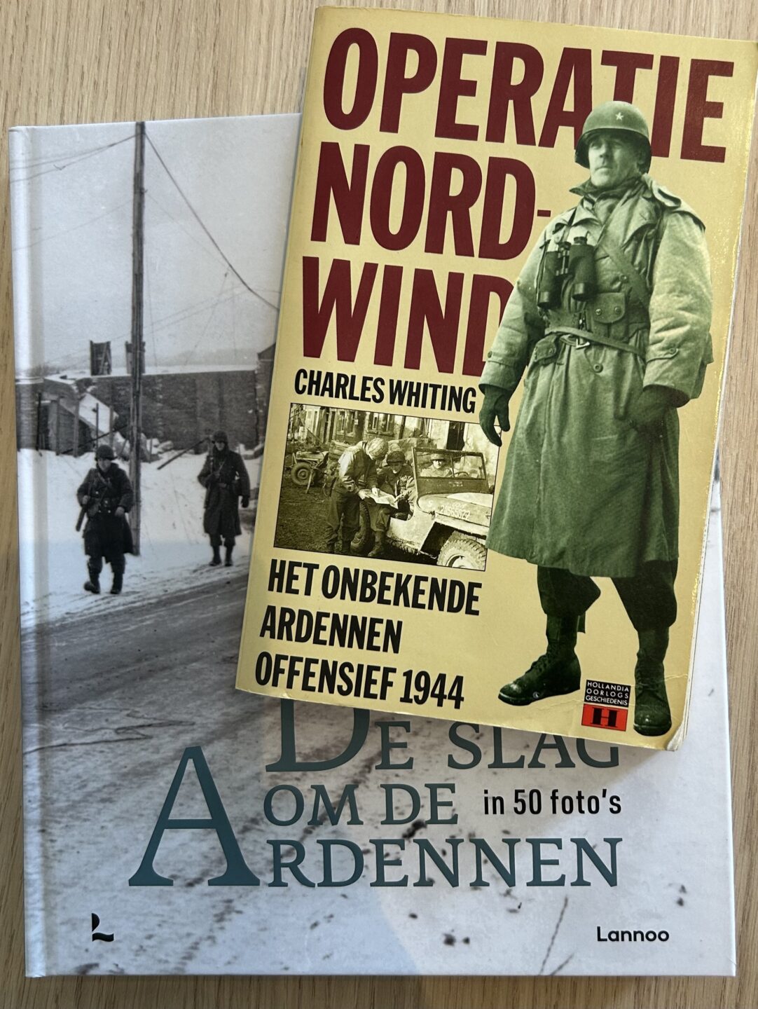
One of these old books is ‘Operation Nordwind’ by Charles Whiting (Dutch translation). Unternehmen Nordwind was the name of the German operation that followed on to support their failing Ardennes offensive, calling for an attack South of the West Wall, into France. I have yet to read the book, so a review will follow later. If you can’t wait, there’s a very good article on Warfare History Network.
The second book in the picture is a Belgian publication called ‘The Battle of the Bulge in 50 Photos’. It’s a pretty book to look at, but it also has quite an original concept: it explains where certain famous pictures of the battle were taken, and also why. War photography was different then. It wasn’t just news gathering and recording history. Often, there was a propaganda aim behind it. On both the German and the American sides.
Scan the QR code to see this location today
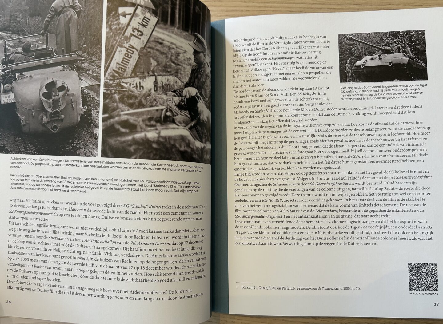
The nifty thing about the photos that are explained in this book is the QR-code that comes with each of them. This will take you straight to that location in Google Streetview. And then you can start exploring.
Even though the title suggests it’s a picture book , there’s still a lot of text. I haven’t read everything yet, but I thought it was very insightful to read about Dinant. The explanation of a photo of the bridge with people fleeing the town can be traced on Google Maps.
Read my other posts related to The Battle of the Bulge

Comments
More books on The Bulge — No Comments
HTML tags allowed in your comment: <a href="" title=""> <abbr title=""> <acronym title=""> <b> <blockquote cite=""> <cite> <code> <del datetime=""> <em> <i> <q cite=""> <s> <strike> <strong>